GetNotes Tools
opengeos/GeoLibre
Tool นี้คืออะไร
GeoLibre เป็นแพลตฟอร์ม GIS แบบโอเพนซอร์สที่ทำงานบนคลาวด์ มีน้ำหนักเบา สำหรับการแสดงภาพ สำรวจ และวิเคราะห์ข้อมูลเชิงพื้นที่ สามารถใช้งานได้ทุกที่ ทั้งบนเว็บ เดสก์ท็อป มือถือ และ Jupyter โดยที่ข้อมูลของคุณยังคงเป็นส่วนตัวและอยู่บนเครื่อง
ข้อมูลโปรเจกต์
ดาว
3.6K
Forks
406
License
MIT
อัปเดต GitHub ล่าสุด
29 ก.ค. 2569
เพิ่มใน GetNotes
30 ก.ค. 2569
Repository
opengeos/GeoLibre
รูปแบบ
เหมาะกับงาน
เหมาะกับอาชีพ
Ecosystem
TypeScript
แปลและเรียบเรียงโดย AI
เนื้อหาฉบับภาษาไทย
ใช้อ่านเพื่อทำความเข้าใจเบื้องต้น โปรดตรวจสอบรายละเอียดสำคัญกับเอกสารต้นฉบับด้านล่าง
GeoLibre














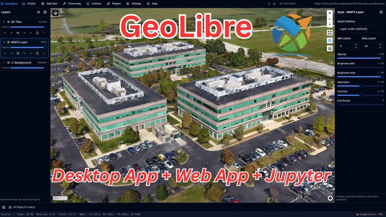
GeoLibre เป็นแพลตฟอร์ม GIS แบบโอเพนซอร์สฟรี มีน้ำหนักเบา และทำงานบนคลาวด์ สำหรับการแสดงภาพ สำรวจ และวิเคราะห์ข้อมูลเชิงพื้นที่ สามารถทำงานได้ทุกที่ที่คุณต้องการ ทั้งในเว็บเบราว์เซอร์ บนเดสก์ท็อป บนมือถือ และภายใน Jupyter notebooks โดยที่ข้อมูลของคุณยังคงอยู่บนเครื่องและเป็นส่วนตัว
GeoLibre สร้างขึ้นด้วย Tauri v2, React, TypeScript, MapLibre GL JS, DuckDB-WASM Spatial และ deck.gl พื้นที่ทำงานเดียวกันนี้สามารถทำงานเป็นแอปพลิเคชันเดสก์ท็อปแบบเนทีฟ แอปพลิเคชัน Android แบบเนทีฟ ในเว็บเบราว์เซอร์ที่ทันสมัยใดก็ได้ และปรับการแสดงผลให้เหมาะสมกับหน้าจอมือถือและหน้าจอขนาดเล็ก
- เปิด GeoLibre Web — แอปพลิเคชันเต็มรูปแบบในเบราว์เซอร์ของคุณ ไม่ต้องติดตั้ง
- ดาวน์โหลดแอปพลิเคชันเดสก์ท็อป — ตัวติดตั้งสำหรับ Windows, macOS และ Linux
- ดาวน์โหลดบน Google Play — แอปพลิเคชัน Android แบบเนทีฟ
- เริ่มต้นใช้งาน — ติดตั้ง, รันจากซอร์สโค้ด และกำหนดค่า
- คุณสมบัติ — รายการคุณสมบัติทั้งหมด
ตัวอย่างการใช้งาน
คลิกภาพหน้าจอใดก็ได้เพื่อเปิดที่ความละเอียดเต็ม หรือคลิกภาพเคลื่อนไหวใดก็ได้เพื่อเล่นวิดีโอคุณภาพเต็ม
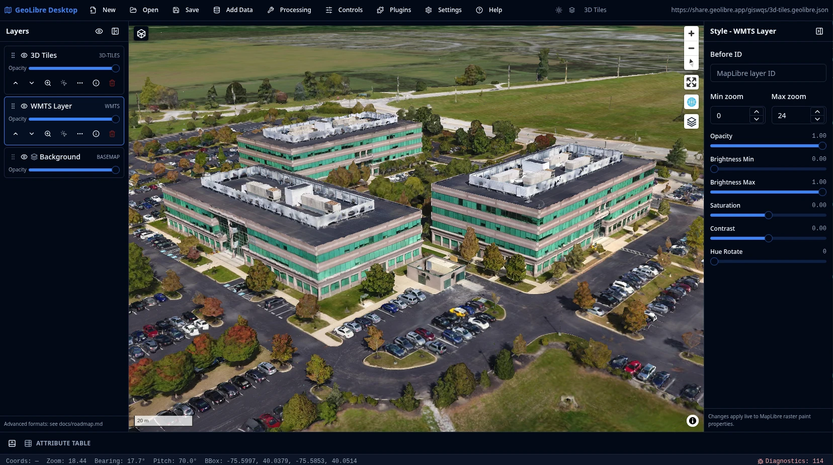
3D Tiles
อาคารและรถไฟใต้ดินใน NYC
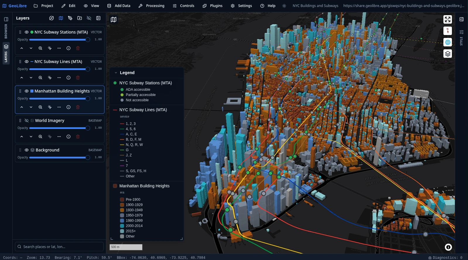
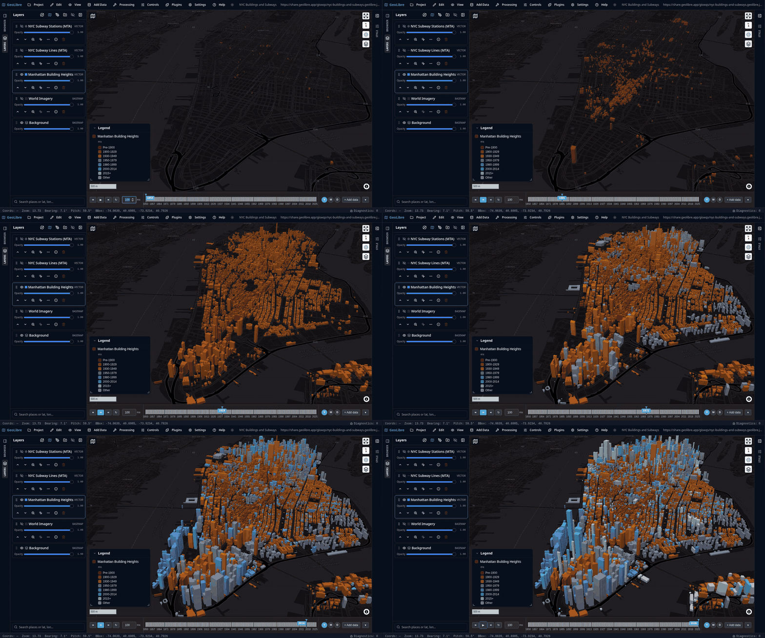
รอยเท้าอาคารในแมนฮัตตันที่ถูกยื่นออกมาเป็น 3 มิติ และระบายสีตามยุคการก่อสร้าง พร้อมด้วยเส้นทางและสถานีรถไฟใต้ดิน MTA อยู่ด้านบน และคำอธิบายสัญลักษณ์ที่สร้างขึ้นโดยอัตโนมัติจากสัญลักษณ์ของเลเยอร์
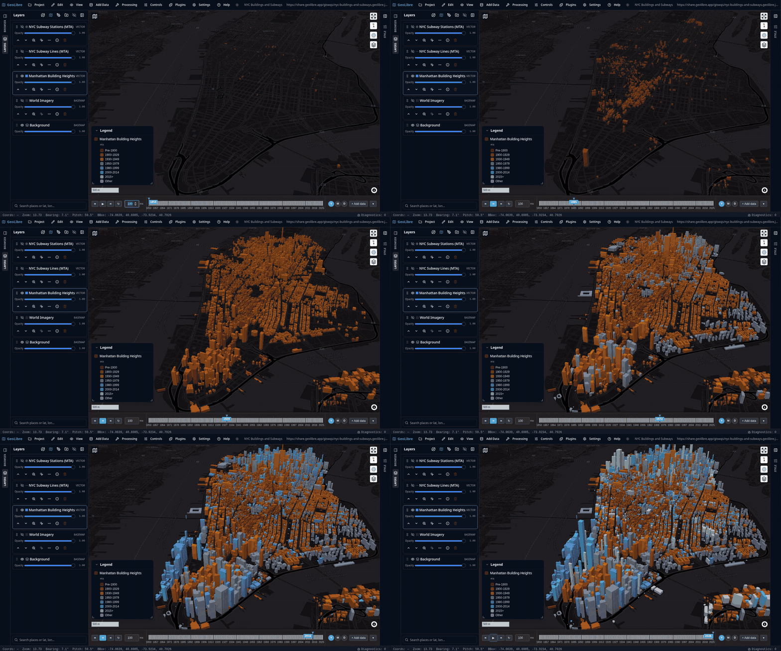
ภาพเคลื่อนไหวข้างล่างนี้จะเลื่อน Time Slider ไปตามปีที่ก่อสร้างอาคาร ตั้งแต่ปี 1850 ถึง 2025 ทำให้แมนฮัตตันปรากฏขึ้นทีละยุคสมัย คลิกเพื่อเล่นวิดีโอคุณภาพเต็ม
แผนที่ฐานดาวเคราะห์
GeoLibre ไม่ได้จำกัดอยู่แค่โลก แผนที่ฐานดาวเคราะห์จาก OpenPlanetaryMap และ USGS Astrogeology ครอบคลุมดวงจันทร์ ดาวอังคาร ดาวพุธ ดาวศุกร์ ดวงจันทร์กาลิเลียน (Io, Europa, Ganymede, Callisto) ไททัน พลูโต และคารอน โดยมีรูปทรงรีต่อโปรเจกต์ เพื่อให้การวัดระยะทาง พื้นที่ และมาตราส่วนตรงกับวัตถุที่คุณกำลังทำแผนที่ ฉากดาวลึกอวกาศที่อยู่เบื้องหลังแต่ละลูกโลกมาจากปลั๊กอิน Atmosphere Effects
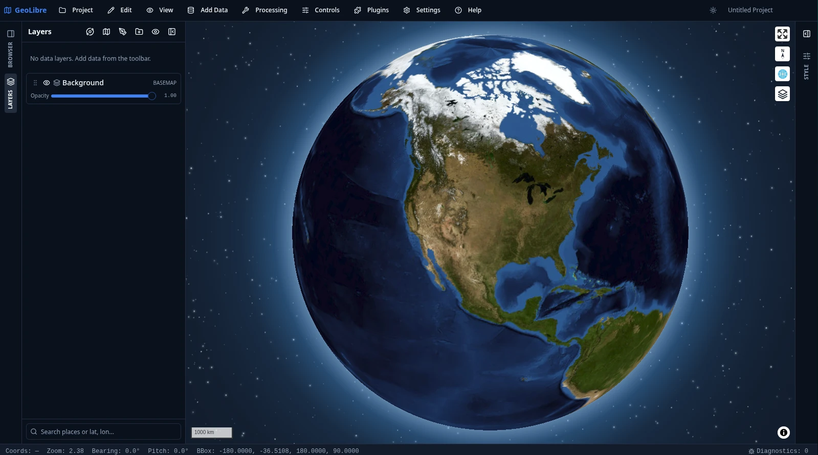
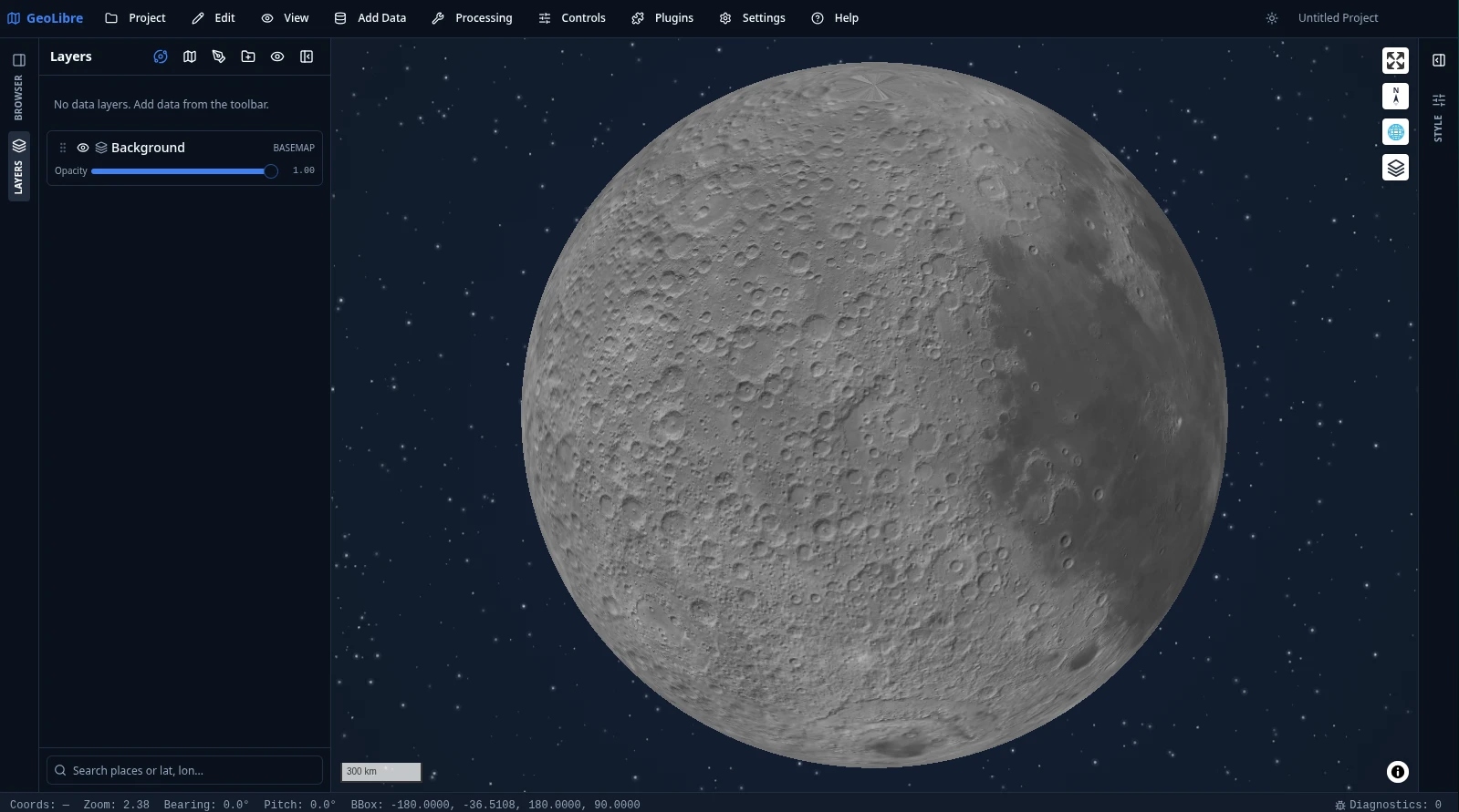
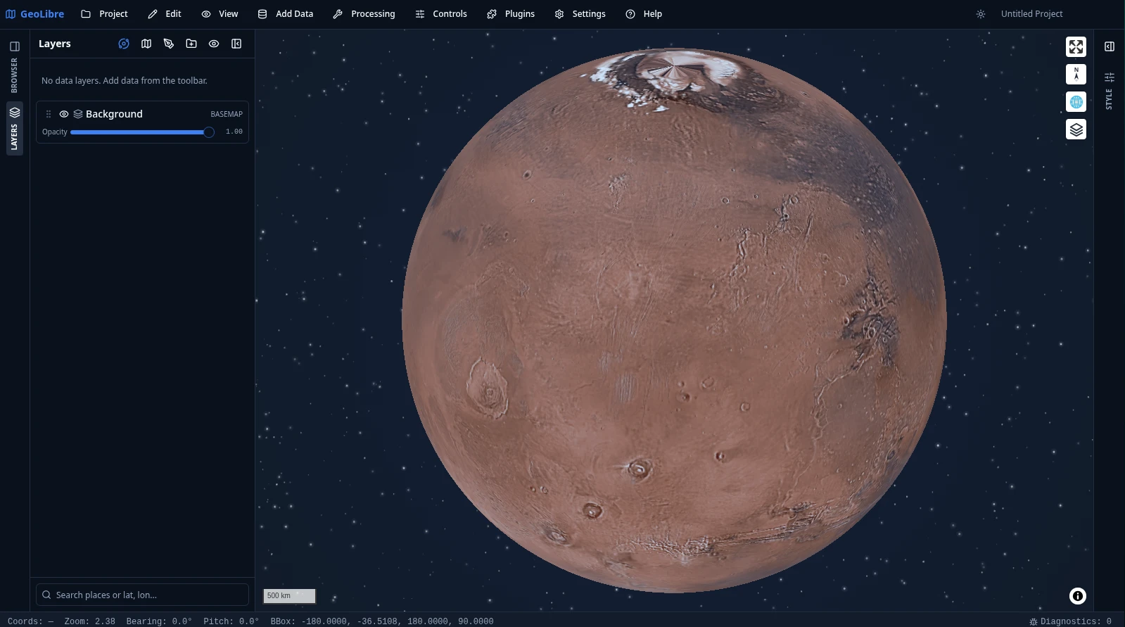
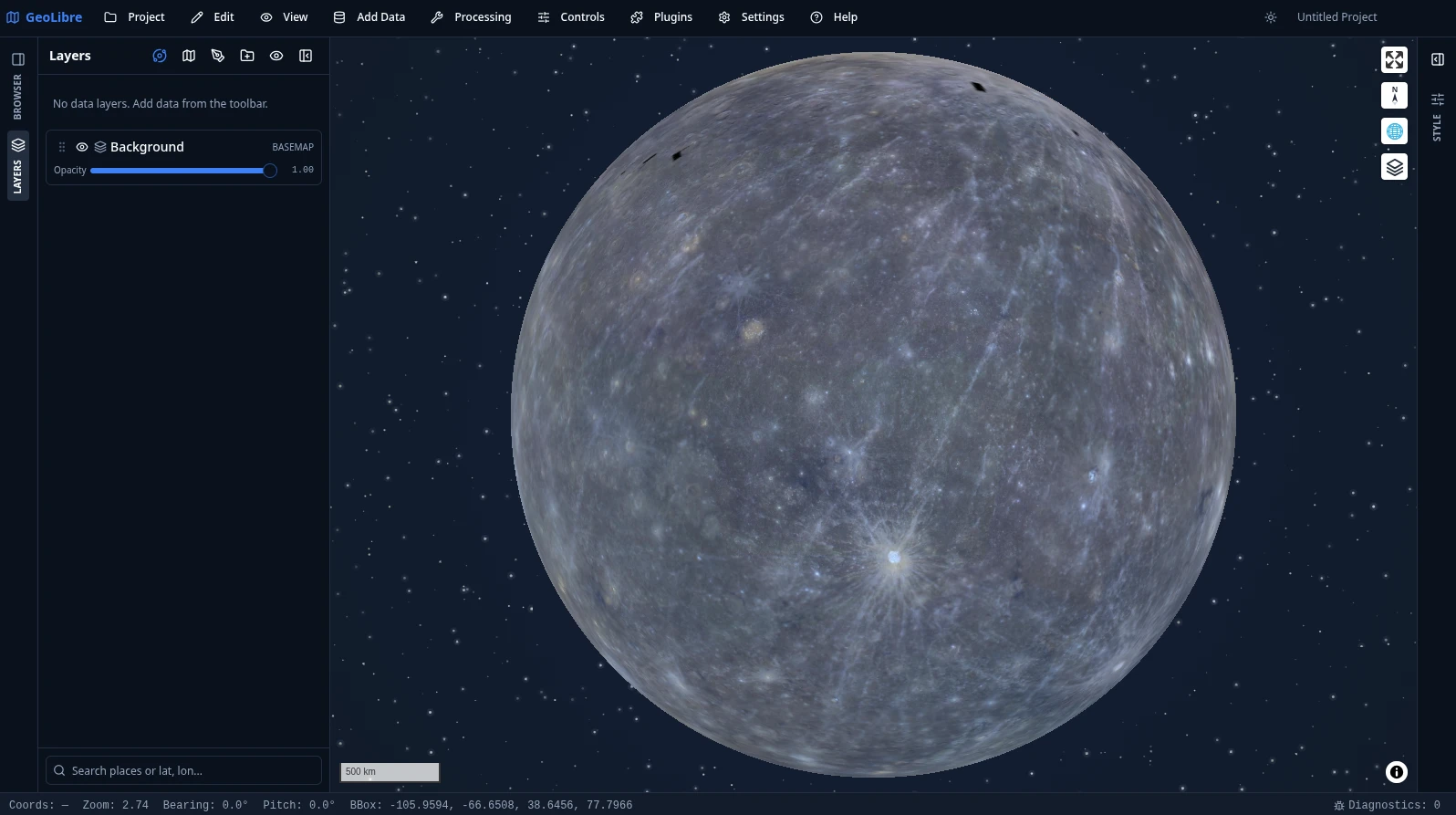
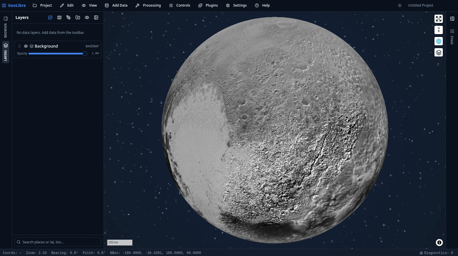
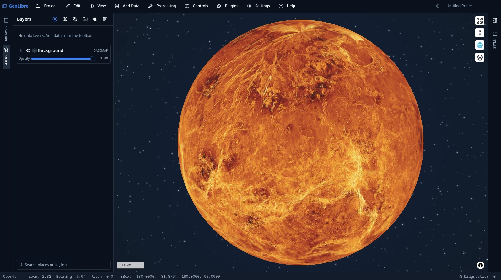
เปลี่ยนวัตถุจากตัวสลับดาวเคราะห์ในแผง Layers ดู ตัวอย่างการใช้งาน สำหรับข้อมูลเพิ่มเติม
วิดีโอสอนการใช้งาน
- GeoLibre 1.0: GIS แบบ Cloud-Native โอเพนซอร์สฟรี ที่ทำงานได้ทุกที่ (เบราว์เซอร์, เดสก์ท็อป & Jupyter)
- การประมวลผลทางภูมิศาสตร์ในเบราว์เซอร์: เครื่องมือ GIS ฟรีมากกว่า 700 รายการใน GeoLibre ไม่ต้องติดตั้ง
เอกสารประกอบ
เอกสารประกอบฉบับเต็ม รวมถึงคู่มือผู้ใช้และบทเรียน มีเผยแพร่ที่ geolibre.app
- เริ่มต้นใช้งาน - ใช้งาน GeoLibre บนเว็บ, เดสก์ท็อป, Android หรือใน Jupyter; รันจากซอร์สโค้ด; รันด้วย Docker; และกำหนดค่าข้อมูลรับรองเสริม
- คุณสมบัติ - รายการคุณสมบัติทั้งหมดของ GeoLibre ที่สามารถทำได้ในปัจจุบัน แบบทีละคุณสมบัติ
- ตัวอย่างการใช้งาน - การนำเสนอด้วยภาพ: 3D Tiles, ข้อมูลเมือง 3 มิติ, แผนที่ฐานดาวเคราะห์, SQL Workspace และการฝัง
- ดาวน์โหลด - ตัวติดตั้งและตัวจัดการแพ็กเกจสำหรับ Windows, macOS และ Linux
- คู่มือผู้ใช้ - ข้อมูลอ้างอิงทีละคุณสมบัติสำหรับอินเทอร์เฟซ, การเพิ่มข้อมูล, เลเยอร์, การจัดรูปแบบ, ตารางแอตทริบิวต์, การควบคุมแผนที่, การประมวลผล, SQL Workspace, การรวมข้อมูล, ปลั๊กอิน, การตั้งค่า และการฝัง
- บทเรียน - เวิร์กโฟลว์แบบลงมือปฏิบัติจริงตั้งแต่ต้นจนจบ: แผนที่แรกของคุณ, ข้อมูล Cloud-Native, การวิเคราะห์เวกเตอร์, การวิเคราะห์ภูมิประเทศ, Spatial SQL และการแชร์และการฝัง
- ข้อมูลอ้างอิง- [สถาปัตยกรรม](https://github.com/opengeos/GeoLibre/blob/main/docs/architecture.md) - [Android](https://github.com/opengeos/GeoLibre/blob/main/docs/android.md) - [iOS](https://github.com/opengeos/GeoLibre/blob/main/docs/ios.md) - [รูปแบบโปรเจกต์](https://github.com/opengeos/GeoLibre/blob/main/docs/project-format.md) - [Plugin API](https://github.com/opengeos/GeoLibre/blob/main/docs/plugin-api.md) - [UI Profiles](https://github.com/opengeos/GeoLibre/blob/main/docs/ui-profiles.md) - [Internationalization](https://github.com/opengeos/GeoLibre/blob/main/docs/i18n.md) - [แพ็กเกจ Python (Jupyter)](https://github.com/opengeos/GeoLibre/blob/main/docs/python.md) - [แผง Notebook](https://github.com/opengeos/GeoLibre/blob/main/docs/notebook.md) - [แผนงาน](https://github.com/opengeos/GeoLibre/blob/main/docs/roadmap.md) - [การมีส่วนร่วม](https://github.com/opengeos/GeoLibre/blob/main/docs/contributing.md) - [วิธีการอ้างอิง](https://github.com/opengeos/GeoLibre/blob/main/docs/citation.md)
ยินดีรับการมีส่วนร่วม ดูคู่มือ การมีส่วนร่วม สำหรับการตั้งค่าการพัฒนา โครงสร้างของ repository และเกณฑ์คุณภาพ
คำขอบคุณ
GeoLibre สร้างขึ้นบนพื้นฐานของชุมชนภูมิสารสนเทศและเว็บแบบโอเพนซอร์สและฟรี ซึ่งรวมถึง MapLibre GL JS, deck.gl, DuckDB-WASM Spatial, Turf.js, Tauri, React และอื่นๆ อีกมากมาย ดูหน้า คำขอบคุณ ฉบับเต็มสำหรับรายชื่อโปรเจกต์และผู้มีส่วนร่วมในชุมชนทั้งหมด
- ปลั๊กอิน Atmosphere Effects (ฉากหลังอวกาศลึก, ท้องฟ้าจำลองแบบพารัลแลกซ์, ดาวหาง และรัศมีบรรยากาศของโลก) ปรับใช้เทคนิคและการออกแบบภาพจากบทความ Globe atmosphere, halo, and comets ของ Leonel Dias — วิธีการใช้ Canvas 2D แบบเลเยอร์, การไล่ระดับสีของรัศมีและการผสมแบบ "screen", การสุ่มตัวอย่างขอบที่ทำให้รัศมีจัดแนวอยู่ใต้การเอียง, และพารามิเตอร์ของท้องฟ้าจำลอง/ดาวหาง
- ผู้ร่วมให้ข้อมูลจากชุมชน — ขอขอบคุณ Ryanphoenix สำหรับการมีส่วนร่วมอันทรงคุณค่ามากมาย รวมถึงรายงานปัญหา, ข้อเสนอแนะ และการปรับปรุง
- ผู้ทดสอบเบต้า — ขอขอบคุณ René van der Velde (เนเธอร์แลนด์) สำหรับการทดสอบเบื้องต้น, รายงานข้อบกพร่องโดยละเอียด และคำขอคุณสมบัติ
การอ้างอิง
หากคุณใช้ GeoLibre ในงานของคุณ โปรดอ้างอิงถึง GeoLibre ได้รับการเก็บถาวรบน Zenodo ซึ่งสร้าง DOI สำหรับทุกการเผยแพร่ concept DOI ด้านล่างนี้จะเชื่อมโยงไปยังเวอร์ชันล่าสุดเสมอ
Wu, Q. (2026). GeoLibre: A lightweight, cloud-native GIS platform for visualizing, exploring, and analyzing geospatial data. Zenodo. https://doi.org/10.5281/zenodo.20785400
คุณยังสามารถใช้ปุ่ม "Cite this repository" ของ GitHub (ซึ่งอ่าน CITATION.cff) เพื่อคัดลอกรายการ APA หรือ BibTeX ที่พร้อมใช้งาน ดูหน้า How to Cite สำหรับรูปแบบเพิ่มเติม
ใบอนุญาต
เอกสารโปรเจกต์
อ่านเอกสารต้นฉบับ
README วิธีติดตั้ง วิธีใช้งาน และข้อกำหนดจาก repository ต้นฉบับ
GeoLibre





A free and open-source, lightweight, cloud-native GIS platform for visualizing, exploring, and analyzing geospatial data. It runs everywhere you do, in the web browser, on the desktop, on mobile, and inside Jupyter notebooks, all while keeping your data local and private.
It also ships 1,000+ geoprocessing tools that run entirely in your browser on WebAssembly — terrain, hydrology, LiDAR, remote sensing, and vector analysis with no server, no install, and no data ever leaving your machine.
GeoLibre is built with Tauri v2, React, TypeScript, MapLibre GL JS, DuckDB-WASM Spatial, and deck.gl. The same workspace runs as a native desktop app, native Android and iOS apps, in any modern web browser, and adapts responsively to mobile and small screens.
- Launch GeoLibre Web — the full app in your browser, nothing to install
- Download the desktop app — Windows, macOS, and Linux installers
- Get it on the Mac App Store — the sandboxed macOS build
- Get it on the App Store — the native iOS app for iPhone and iPad
- Get it on Google Play — the native Android app
- Get the Chrome extension — open datasets you find on any webpage in GeoLibre
- Use the Python package — embed and control the full app in Jupyter notebooks
- Use the R package — build interactive maps in RStudio, Quarto, R Markdown, and Shiny
- 1,000+ geoprocessing tools — the full toolbox, in the browser
- Get started — install, run from source, and configure
- Features — the complete feature list
Demos
Click any screenshot to open it at full resolution, or any animation to play the full-quality video.
3D Tiles
NYC buildings and subways
Manhattan building footprints extruded in 3D and colored by construction era, with the MTA subway lines and stations on top and a legend generated automatically from the layers' symbology.
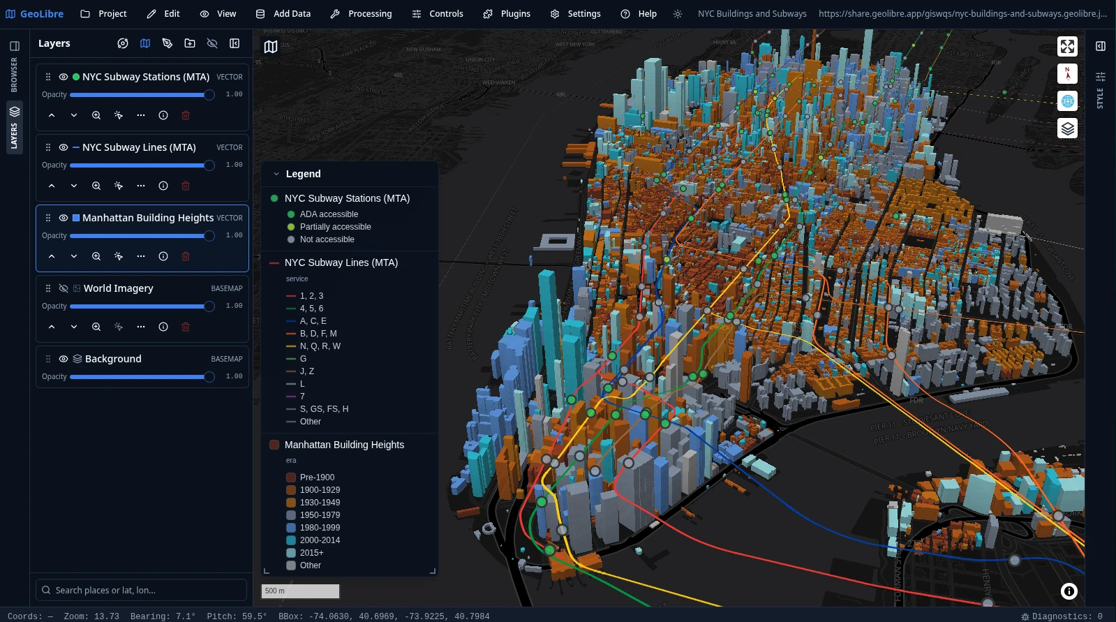
The animation below runs the Time Slider along the buildings' construction year, from 1850 to 2025, so Manhattan fills in era by era. Click it to play the full-quality video.
Planetary basemaps
GeoLibre is not limited to Earth. Planetary basemaps from OpenPlanetaryMap and USGS Astrogeology cover the Moon, Mars, Mercury, Venus, the Galilean moons (Io, Europa, Ganymede, Callisto), Titan, Pluto, and Charon, with a per-project ellipsoid so distance, area, and scale measurements match the body you are mapping. The deep-space starfield behind each globe comes from the Atmosphere Effects plugin.
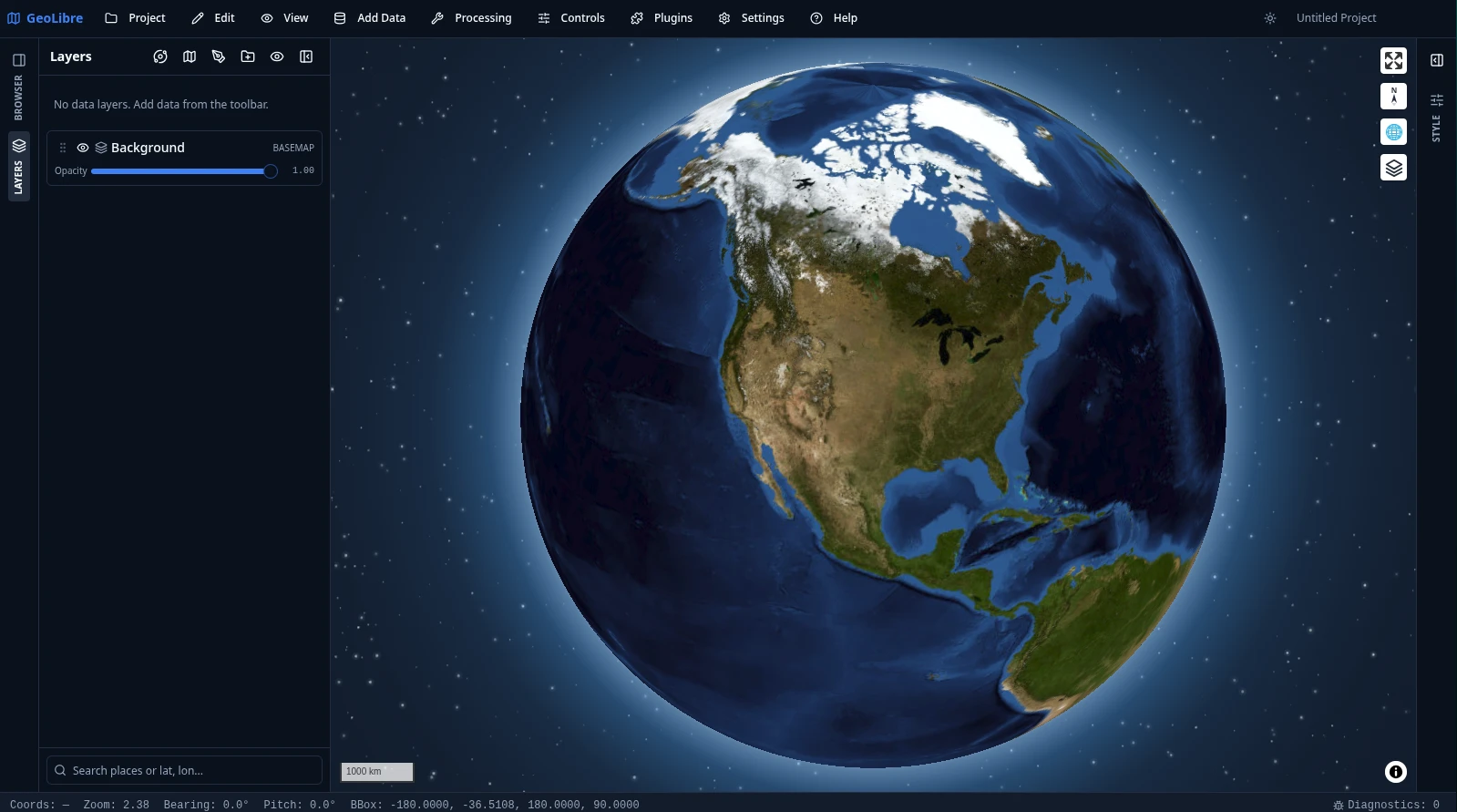
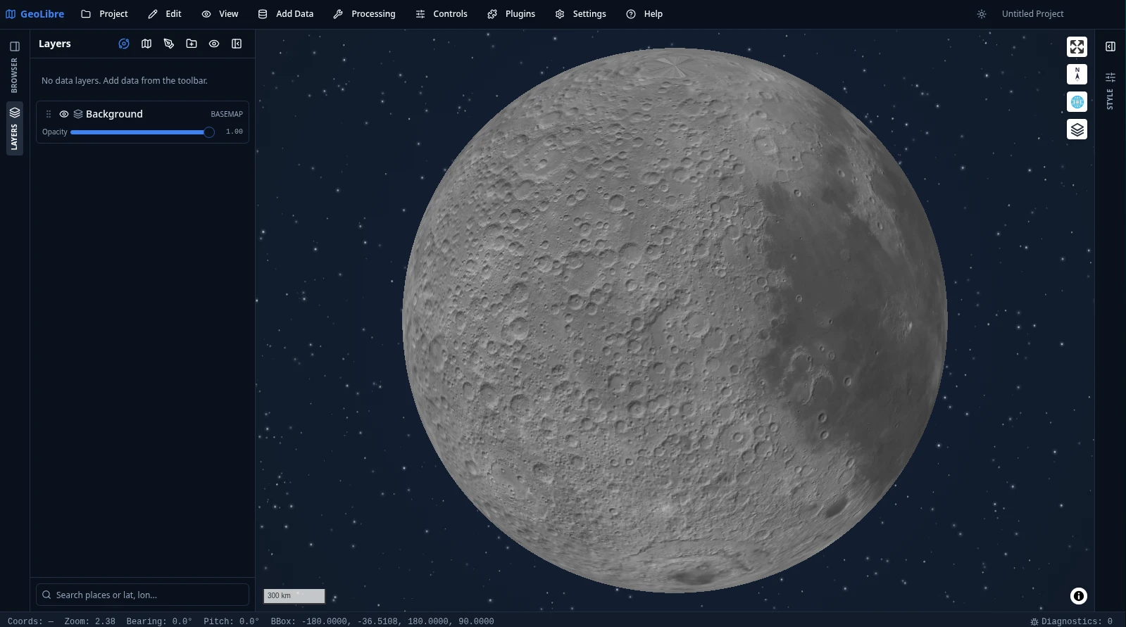
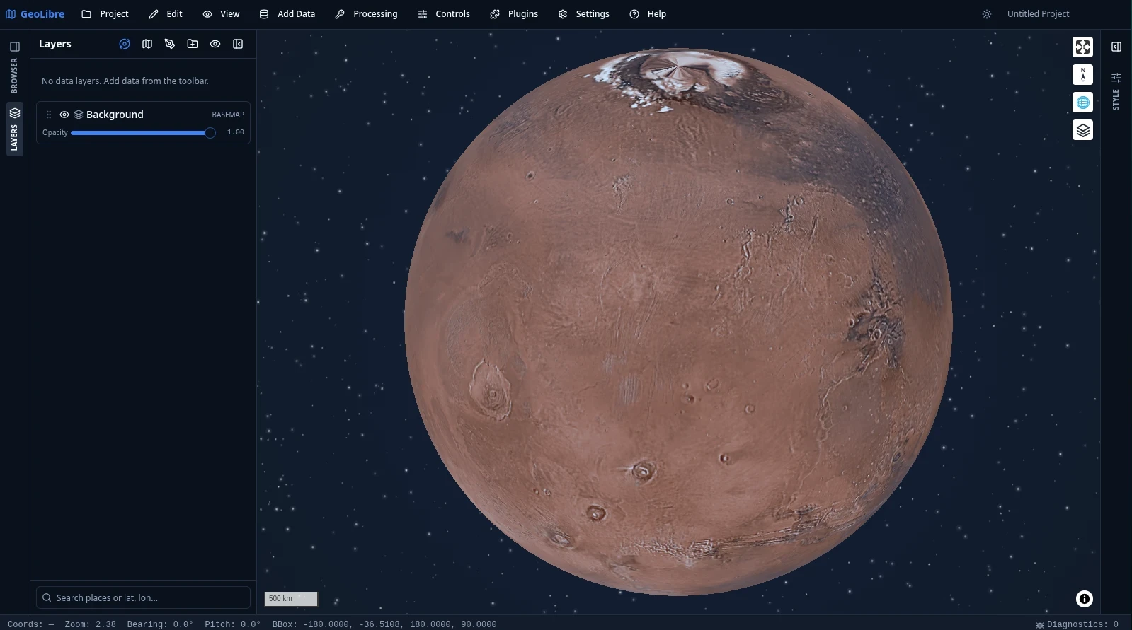
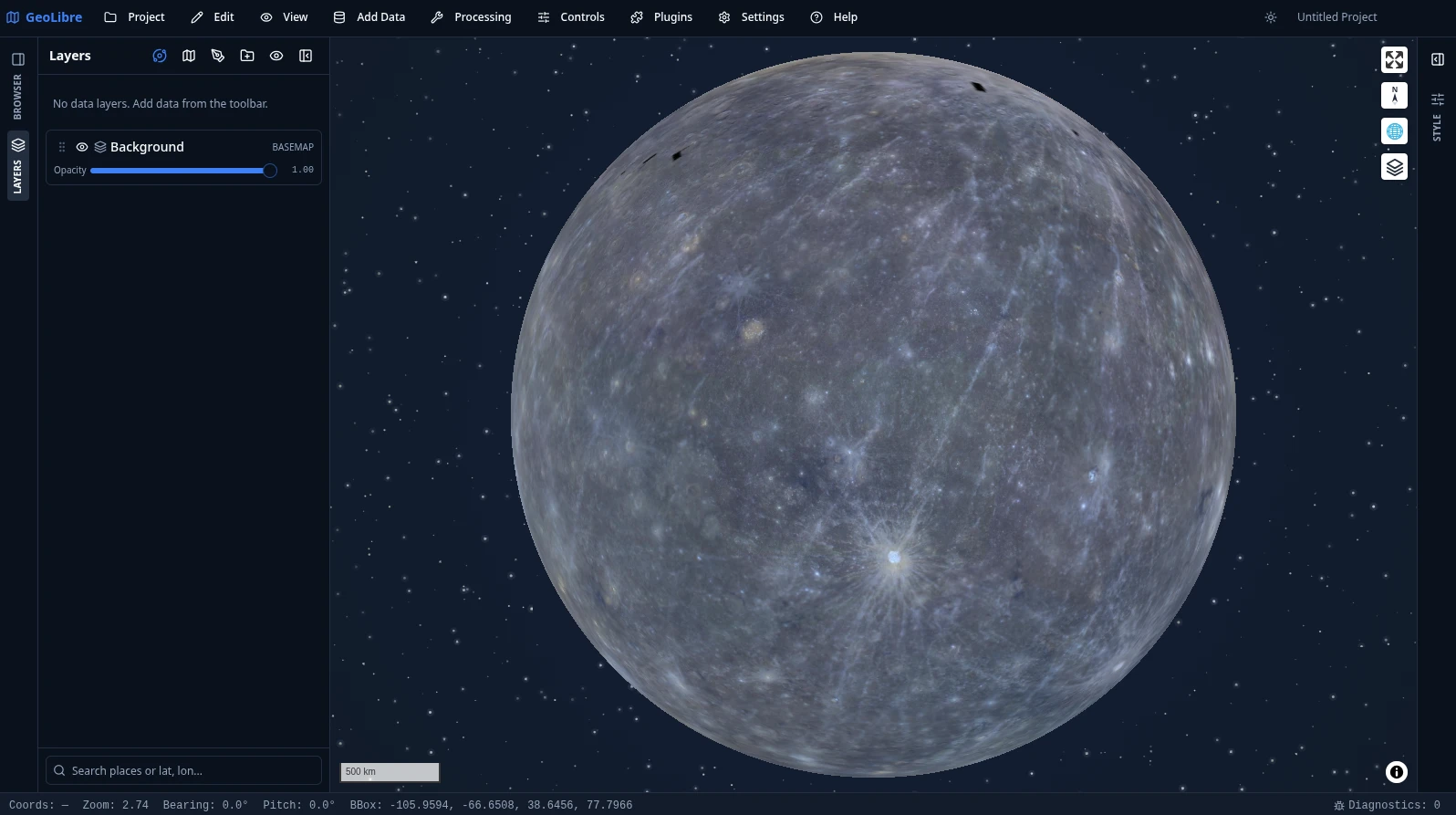
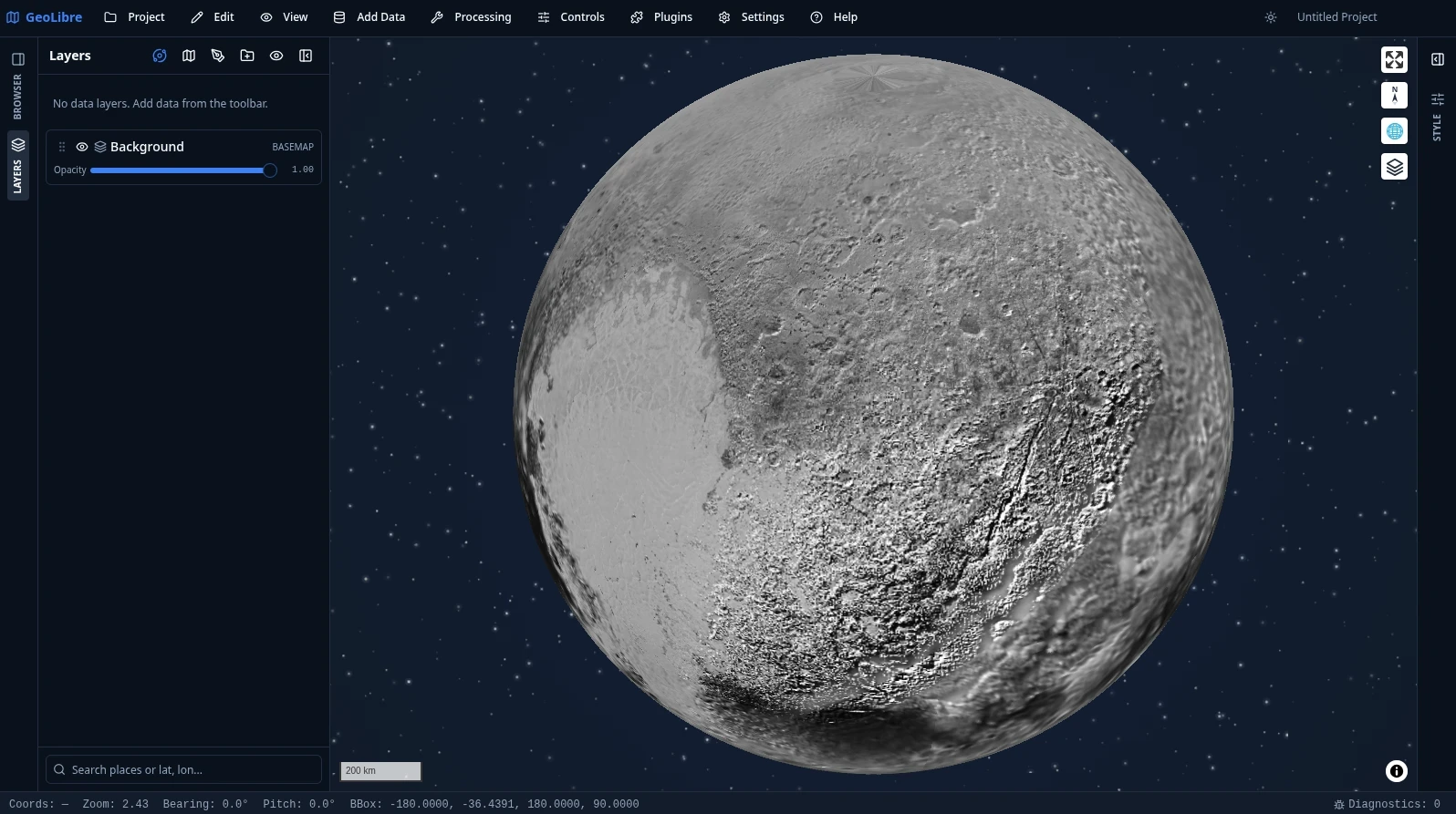
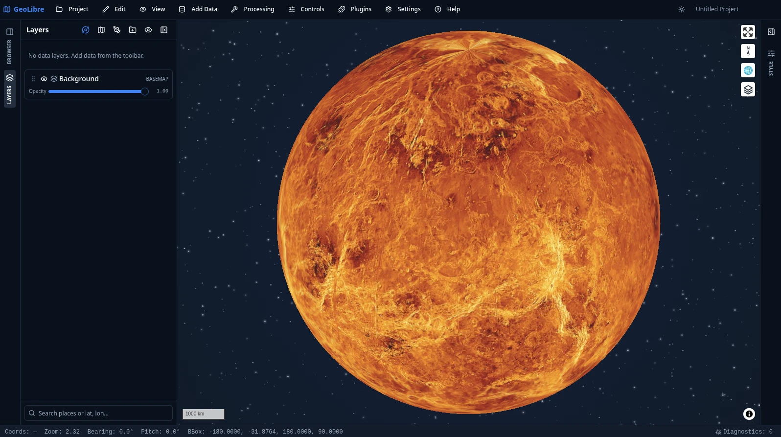
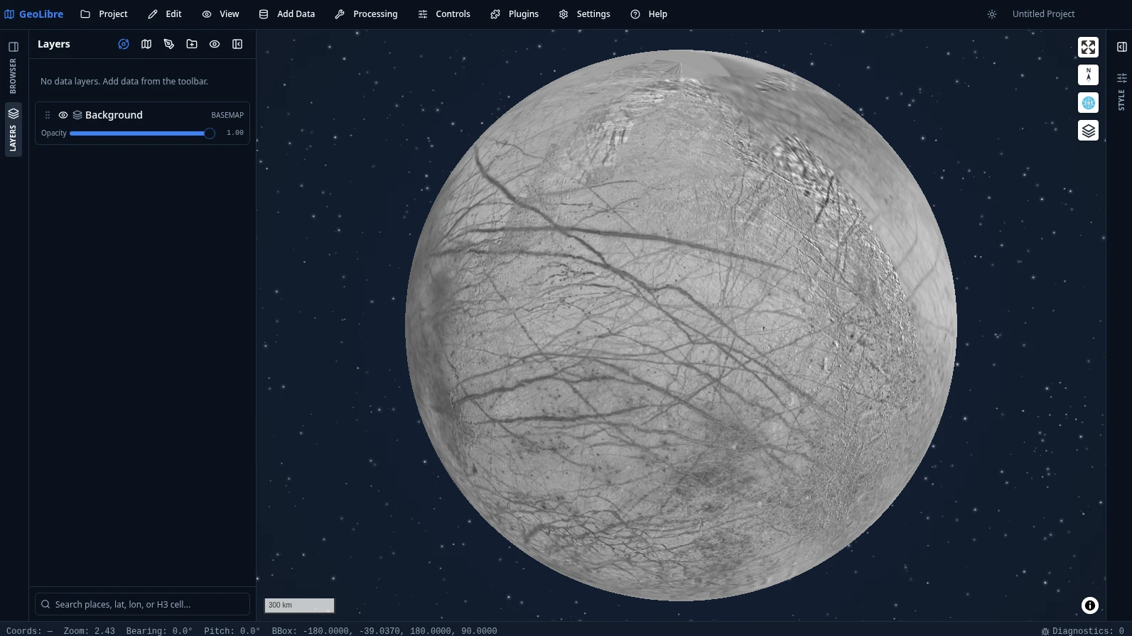
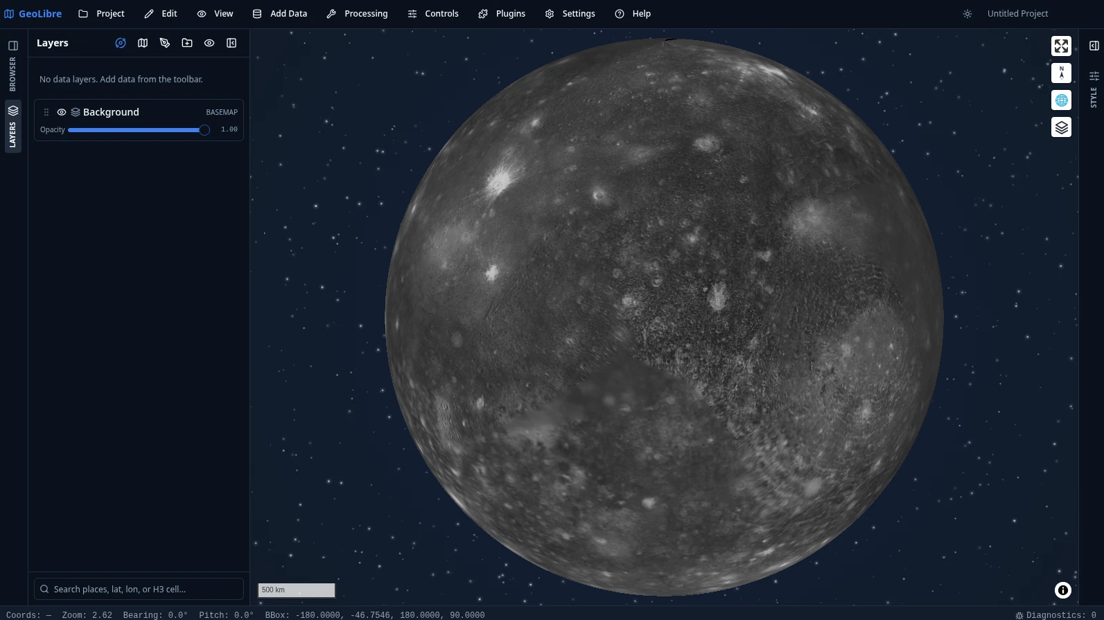
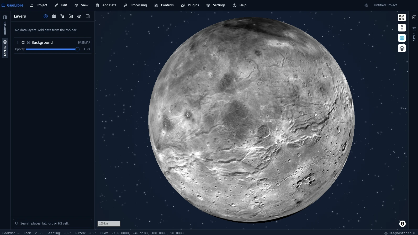
Switch bodies from the planet switcher in the Layers panel. See Demos for more.
Video tutorials
- GeoLibre 1.0: A Free, Open-Source Cloud-Native GIS That Runs Anywhere (Browser, Desktop & Jupyter)
- Geoprocessing in the Browser: 700+ Free GIS Tools in GeoLibre, Zero Install
- Access Free High-Resolution Disaster Satellite Imagery in Your Browser
- Regularize Building Footprints in the Browser with GeoLibre
- GeoLibre + GeoLens: A Modern GIS Stack for Self-Hosting Geospatial Data
- Create Reusable GIS Workflows with GeoLibre Model Builder and AI Assistant
- Mapping the 2026 Nepal Floods with Free High-Resolution Satellite Imagery
- Building Cloud-Native GIS Workflows with GeoLibre
- Image Georeferencing Using GeoLibre in the Browser
All of them, with chapters and summaries, are on the Video Tutorials page.
Geoprocessing: 1,000+ tools, zero install
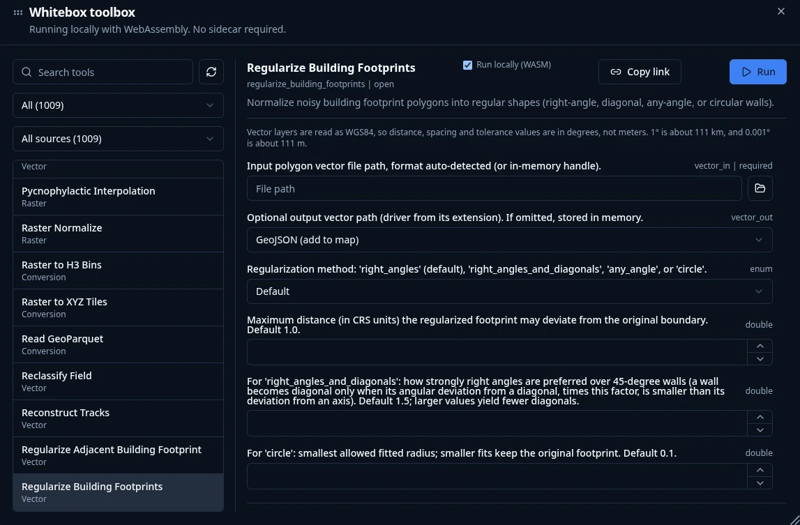
Processing → Whitebox Toolbox opens a toolbox of 1,000+ geoprocessing tools that execute in the browser through a WebAssembly runtime with native raster and vector I/O. There is no Python sidecar to install and no server to call — the tools, your data, and the results all stay on your machine, so the full toolbox is available on GeoLibre Web, on the desktop app, and on Android alike.
The tools come from the Whitebox Next Gen suite plus GeoLibre's own WASM tools, and are browsable by category straight from the Processing menu:
| Category | Tools | Examples |
|---|---|---|
| Vector | 313 | overlays, buffers, joins, cleaning, topology, generalization |
| Raster | 256 | algebra, filters, reclassification, zonal and focal statistics |
| Remote sensing | 154 | spectral indices, band math, classification, change detection |
| Hydrology | 100 | flow accumulation, watersheds, stream networks, depression filling |
| Terrain | 99 | slope, aspect, hillshade, curvature, ruggedness, viewsheds |
| LiDAR | 65 | point-cloud filtering, ground classification, DEM/DSM generation |
| Conversion | 49 | format translation to cloud-native GeoParquet, PMTiles, and COG |
| Network | 26 | connectivity, cost distance, and routing analysis |
| Projection | 4 | reprojection for raster and vector data |
Any tool is deep-linkable with a ?tool= URL parameter that preselects it and
pre-fills its form. See the Processing Tools guide
for details, and Geoprocessing in the Browser for
a video walkthrough.
Documentation
Full documentation, including the User Guide and Tutorials, is published at geolibre.app.
- Getting Started - use GeoLibre on the web, desktop, Android, iOS, or in Jupyter; run it from source; run it with Docker; and configure optional credentials.
- Features - the complete, feature-by-feature list of what GeoLibre can do today.
- Demos - a visual tour: 3D Tiles, 3D city data, planetary basemaps, the SQL Workspace, and embeds.
- Downloads - installers and package managers for Windows, macOS, and Linux.
- User Guide - a feature-by-feature reference for the interface, adding data, layers, styling, the attribute table, map controls, processing, the SQL Workspace, data integrations, plugins, settings, and embedding.
- Tutorials - hands-on, end-to-end workflows: your first map, cloud-native data, vector analysis, terrain analysis, spatial SQL, and sharing and embedding.
- Reference- [Architecture](https://github.com/opengeos/GeoLibre/blob/main/docs/architecture.md) - [Android](https://github.com/opengeos/GeoLibre/blob/main/docs/android.md) - [iOS](https://github.com/opengeos/GeoLibre/blob/main/docs/ios.md) - [Project format](https://github.com/opengeos/GeoLibre/blob/main/docs/project-format.md) - [Plugin API](https://github.com/opengeos/GeoLibre/blob/main/docs/plugin-api.md) - [UI Profiles](https://github.com/opengeos/GeoLibre/blob/main/docs/ui-profiles.md) - [Internationalization](https://github.com/opengeos/GeoLibre/blob/main/docs/i18n.md) - [Python package (Jupyter)](https://github.com/opengeos/GeoLibre/blob/main/docs/python.md) — also supports `from geolibre import DashMap` for Dash (install `geolibre[dash]`) - [R package (RStudio, Quarto, and Shiny)](https://github.com/opengeos/GeoLibre/blob/main/docs/r.md) - [Notebook Panel](https://github.com/opengeos/GeoLibre/blob/main/docs/notebook.md) - [Roadmap](https://github.com/opengeos/GeoLibre/blob/main/docs/roadmap.md) - [Contributing](https://github.com/opengeos/GeoLibre/blob/main/docs/contributing.md) - [How to Cite](https://github.com/opengeos/GeoLibre/blob/main/docs/citation.md) - [Become a Sponsor](https://github.com/opengeos/GeoLibre/blob/main/docs/sponsor.md)
Contributions are welcome. See the Contributing guide for the development setup, repository layout, and quality gate.
Sponsor
GeoLibre is free and open source, and stays that way. If it is useful to you or your team, sponsorship is the most direct way to keep development, hosting, and cross-platform distribution going.
- GitHub Sponsors - monthly or one-time, billed through your GitHub account.
- Buy Me a Coffee - a quick one-off contribution, no account required.
See the Become a Sponsor page for what sponsorship supports and for other, free ways to help.
Acknowledgements
GeoLibre is built on the free and open-source geospatial and web communities — including MapLibre GL JS, deck.gl, DuckDB-WASM Spatial, Turf.js, Tauri, React, and many more. See the full Acknowledgements page for the complete list of projects and community contributors.
- The Atmosphere Effects plugin (deep-space backdrop, parallax starfield, comets, and the globe atmosphere halo) adapts the technique and visual design from Leonel Dias's article Globe atmosphere, halo, and comets — the layered Canvas 2D approach, the halo gradient and "screen" blend, the limb-sampling that keeps the halo aligned under pitch, and the starfield/comet parameters.
- Community contributors — thanks to Ryanphoenix for many valued contributions, including issue reports, feedback, and improvements.
- Beta testers — thanks to René van der Velde (Netherlands) for early testing, detailed bug reports, and feature requests.
Citation
If you use GeoLibre in your work, please cite it. GeoLibre is archived on Zenodo, which mints a DOI for every release. The concept DOI below always resolves to the latest version.
Wu, Q. (2026). GeoLibre: A lightweight, cloud-native GIS platform for visualizing, exploring, and analyzing geospatial data. Zenodo. https://doi.org/10.5281/zenodo.20785400
You can also use GitHub's "Cite this repository" button (which reads CITATION.cff) to copy a ready-made APA or BibTeX entry. See the How to Cite page for more formats.